Dive into the Rising Tides: Exploring Sea Levels in the Arun Area
Did you know that understanding sea level rise is crucial for coastal communities? Climate Central’s sea level rise and coastal flood maps provide valuable insights based on peer-reviewed science, helping us identify potential risks.
These maps, though not perfect, serve as screening tools, highlighting areas that require deeper investigation. By using global-scale datasets, they offer a broader perspective on elevation, tides, and coastal flood likelihoods.
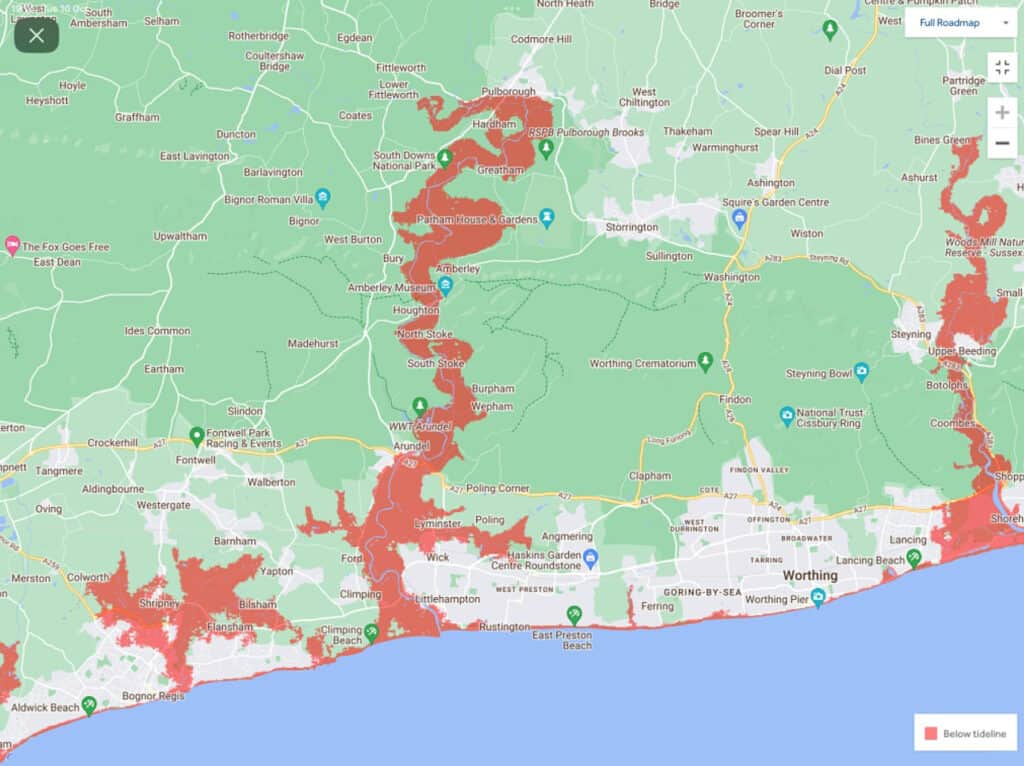
In the Arun area, these maps reveal areas below the selected water level, with a clear path to the ocean, shaded in red. Keep in mind that areas seemingly protected by ridges or levee may not be shaded by default.
Whether you’re a resident or simply curious about our coastal future, these maps can spark important conversations and prompt further exploration of the risks we may face. Let’s stay informed and work together to protect our beautiful shores!